 04/15/24 - 66 New Stories - REAL Environmental & Conservation Leadership In PA: http://tinyurl.com/msuwtctm
| Share this: | ||||

|

|

|

|

|
|
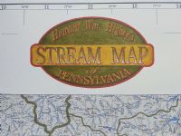
Reviving The ‘Lost’ Higbee Map Of Pennsylvania’s 86,000 Miles Of Streams
|
|
By Alexandra McLaughlin, Penn State News Interested in exploring new fishing, boating or hiking spots? Curious about how water connects throughout the state? A map featuring Pennsylvania’s 86,000 stream miles is available from Penn State Extension. The map includes major and minor streams, rivers, lakes, and other water features with labels clear enough to trace the flow of water throughout Pennsylvania. “This highly detailed map of all the stream miles in Pennsylvania is a really cool and unique resource,” said Jennifer Fetter, water resources extension educator and team leader. Pennsylvania has more stream miles than any other state apart from Alaska. “It’s hard to walk around Pennsylvania without tripping over a stream,” Fetter said. “It took quite a bit of effort to find, identify and map all of these streams.” The map details originally were hand-drawn by Howard Higbee, professor of soil science in Penn State’s College of Agricultural Sciences from 1935 to 1966. Fetter explained that while Higbee’s primary goal was mapping the soil resources of Pennsylvania, he understood the important role that water plays in soil science. Higbee struck out to map all of Pennsylvania’s streams. He confirmed the distances by driving around the state with his calibrated car odometer. Initially published in 1965, the map was lost for some time, and copies became collector’s items and historical treasures. Vivid Publishing eventually put the map back into print with Penn State Extension offering copies for purchase. The map could benefit sportfishing enthusiasts, boaters, outdoor explorers and map lovers. It measures approximately 35 inches by 57 inches and folds down to 9 inches by 11 inches. Along with helping recreational water users and outdoors enthusiasts, the map also could serve as a teaching tool, Fetter pointed out. Teachers and environmental educators could use the map to help people better understand their relationship with water by teaching them about the water where they live and the boundaries of their watersheds. While the map includes other features, such as cities, the streams are the focal point. According to Fetter, this stands in contrast to many maps. “Most maps are not featuring the streams, but something else — where the roads are, where the cities are, where landmarks, parks and forests are,” she said. “Oftentimes, the little bit of water included in mapping is more of a reference point. Waterways have been fractured and details are missing. It’s not as good of a picture of where streams really are.” The map is available for $19.95 on the Penn State Extension website. [How Clean Is Your Stream? [Professor Higbee’s 1965 count of 86,000 miles of Pennsylvania streams was very, very close to the official 85,568 today. [To find out how clean all those streams are near you, visit DEP’s 2022 Water Quality Report webpage and zoom in on your watershed.] (Reprinted from Penn State News.) NewsClips: -- Wilkes-Barre Times: Group Helps Those With Mobility Impairments Stay Active At Frances Slocum State Park -- TribLive - Mary Ann Thomas: $3.5 Million Purchase Of Bridge, Rail Line, Opens Path To Armstrong Trail Expansion -- Williamsport Sun: Repurposed Railroad Bridge For Bald Eagle Valley Trail Over Susquehanna River To Be Dedicated -- Republican Herald: Schuylkill River Trail Expansions In The Works -- Register Now! Lebanon Valley Conservancy Tower To Town 10-Miler Oct. 2 -- PennLive - Marcus Schneck: Site Announced For First State Forest Area For Motorized Recreation -- York Dispatch Editorial: New Motorized Recreation Area Big Win For PA -- House Democratic Policy Committee Summary Of Hearing On Healthy Parks & Open Spaces In Philadelphia -- WHYY: Revised FDR Park Plan Includes More Nature, No Golf In Philadelphia -- Inquirer: 33-Acre Wetland Project At FDR Park In Philadelphia Will Break Ground Soon -- Warren Times: Civilian Conservation Corps Contributions Remembered At Friday Event -- Warren Times: Civilian Conservation Corps Service Changed Life’s Path For Edwin Zevotek -- TribLive: Woman Dies In Ohiopyle Rafting Accident -- Scranton Times: PA Natural Heritage Program Annual Report Released Related Articles: -- PA Supreme Court: Accounting Required For Environmental Rights Amendment Trust Fund Money From State Forest Oil & Gas Drilling - By John C. Dernbach, Commonwealth Law School, Widener University [PaEN] -- DCNR Announces $1.5 Million Improvements At Seven Tubs Recreation Area In Luzerne County -- DCNR Announces Infrastructure Improvements To Yellow Creek State Park, Indiana County -- WeConservePA 2-Part Webinar: Grants - Finding, Writing And Managing Nov. 9 & 16 [PaEN] -- Feature: 'Every Trail Sparks A Story' - Jonas Mountain Nature Preserve, Monroe County; Sept. 24 Fall Colors Hike - By Carol Hillestad, For Pocono Heritage Land Trust [PaEN] -- DCNR Updates Cost Of Ohiopyle State Park Whitewater Launches -- DCNR Prohibits Hunting With Firearms In Four State Parks In Southeast PA -- Natural Lands Partners To Preserve Forest Around Historic Isabella Furnace In Chester County [PaEN] -- PA Natural Heritage Program Celebrates 40 Years Of Discovery - New Species, Solving Mysteries, Finding Rare Species In New Places [PaEN] -- Agriculture, DCNR Celebrate Honey Bee Day, Aug. 20; Bees Play A Critical Role In Food Production, Biodiversity [PaEN] -- August 19 Take Five Fridays With Pam From PA Parks & Forests Foundation [PaEN] [Posted: August 15, 2022] |
|
|
8/22/2022 |
|
| Go To Preceding Article Go To Next Article |